Combination Of Rising Sea Levels And Subsiding Land Endanger Louisiana Coast
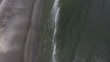
GRAND ISLE, LA - AUGUST 24: Waters from the Gulf of Mexico lap up on the shoreline of the newly restored Caminada Headland, a 13-mile-long barrier island system that buffers the Louisiana coast from tropical storms and surge, August 24, 2019 in Grand Isle, Louisiana. The Coastal Protection and Restoration Authority restored the crucial protective land mass and calls it the state's largest ever restoration project to date. The $216 million project was funded largely through criminal fines paid by BP and Transocean, owner of the Deepwater Horizon oil rig. According to researchers at the National Oceanic and Atmospheric Administration (NOAA), Louisiana's combination of rising waters and sinking land give it one of the highest rates of relative sea level rise on the planet. Since the 1930s, Louisiana has lost over 2,000 square miles of land and wetlands, an area roughly the size of Delaware. In the past 30 years, as subsidence continues and the effects of climate change increase, Louisiana has been losing its coastal landscape at the rate of almost a football field’s worth of land every hour. (Footage by Drew Angerer/Getty Images)


PURCHASE A LICENSE
Get personalized pricing by telling us when, where, and how you want to use this asset.
DETAILS
Credit:
Editorial #:
1175280014
Collection:
Getty Images Editorial Footage
Date created:
August 24, 2019
Upload date:
License type:
Rights-ready
Release info:
Not released. More information
Clip length:
00:00:24:02
Location:
Avery Island, Louisiana, United States
Mastered to:
QuickTime 10-bit ProRes 422 Standard 4K 3840x2160 29.97p
Source:
Getty Images Editorial Footage
Object name:
louisianavideo008.mov