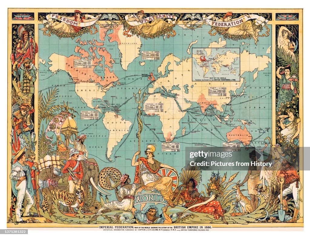
Map of the World showing the British Empire highlighted in red, London, 1886.
United Kingdom: Map of the World showing the British Empire highlighted in red, London, 1886. The British Empire comprised the dominions, colonies, protectorates, mandates and other territories ruled or administered by the United Kingdom. It originated with the overseas colonies and trading posts established by England in the late 16th and early 17th centuries. At its height, it was the largest empire in history and, for over a century, was the foremost global power. (Photo by: Pictures From History/Universal Images Group via Getty Images)

PURCHASE A LICENSE
How can I use this image?
kr. 2.200,00
DKK
Getty ImagesMap of the World showing the British Empire highlighted in red,..., News Photo Map of the World showing the British Empire highlighted in red,... Get premium, high resolution news photos at Getty ImagesProduct #:1371381322
 Map of the World showing the British Empire highlighted in red,... Get premium, high resolution news photos at Getty ImagesProduct #:1371381322
kr.3.000kr.850
Getty Images
In stockPlease note: images depicting historical events may contain themes, or have descriptions, that do not reflect current understanding. They are provided in a historical context. Learn more.
DETAILS
Restrictions:
Contact your local office for all commercial or promotional uses.
Credit:
Editorial #:
1371381322
Collection:
Universal Images Group
Date created:
January 01, 1886
Upload date:
License type:
Release info:
Not released. More information
Source:
Universal Images Group Editorial
Object name:
1060_05_cpa0037016
Max file size:
5100 x 3914 px (17.00 x 13.05 in) - 300 dpi - 13 MB
- Map,
- British Empire,
- World Map,
- Colonialism,
- Empire,
- 19th Century Style,
- 19th Century,
- Africa,
- England,
- India,
- UK,
- Colony - Group of Animals,
- Asia,
- History,
- Archival,
- Britannia,
- Imperialism,
- Australia,
- Business,
- 1880-1889,
- Business Finance and Industry,
- Canada,
- Cartography,
- Chart,
- Color Image,
- Horizontal,
- Human Interest,
- London - England,
- New Zealand,
- Photography,
- Red,