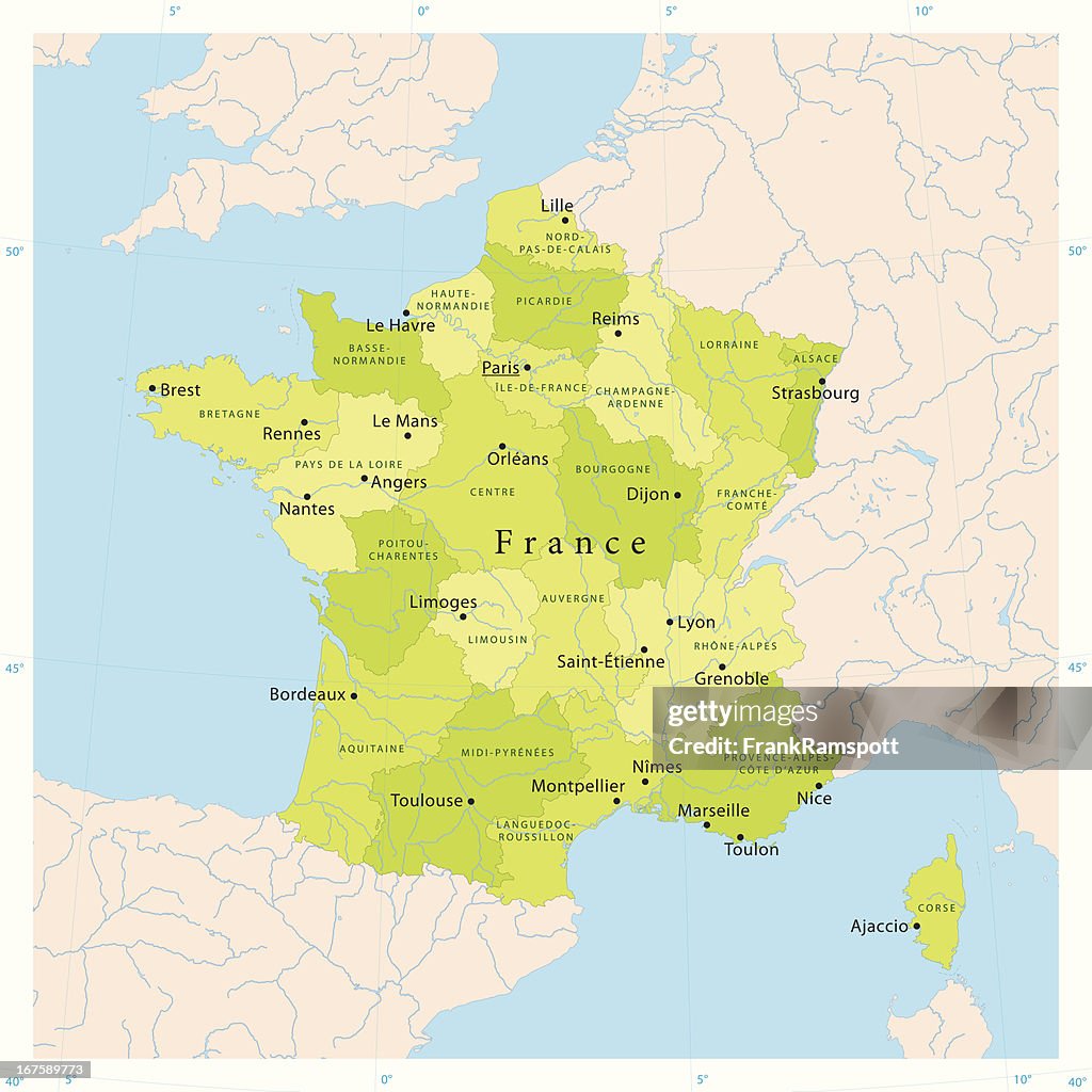
France Vector Map - stock illustration
Highly detailed vector map of France. File was created on August 30, 2011. The colors in the .eps-file are ready for print (CMYK). Included files: EPS (v8) and Hi-Res JPG.
Get this image in a variety of framing options at Photos.com.
PURCHASE A LICENSE
All Royalty-Free licenses include global use rights, comprehensive protection, simple pricing with volume discounts available
kr. 2.200,00
DKK
Getty ImagesFrance Vector Map High-Res Vector Graphic Download premium, authentic France Vector Map stock illustrations from Getty Images. Explore similar high-resolution stock illustrations in our expansive visual catalogue.Product #:167589773
Download premium, authentic France Vector Map stock illustrations from Getty Images. Explore similar high-resolution stock illustrations in our expansive visual catalogue.Product #:167589773kr.2.200kr.280
Getty Images
In stockDETAILS
Credit:
Creative #:
167589773
License type:
Collection:
DigitalVision Vectors
Max file size:
4111 x 4111 px (13.70 x 13.70 in) - 300 dpi - 4 MB
Upload date:
Release info:
Model and property released
Categories:
- Map,
- France,
- Non-Urban Scene,
- Europe,
- Paris - France,
- Vector,
- Rhone River,
- Satellite View,
- Bordeaux,
- Loire Valley,
- Mediterranean Sea,
- Atlantic Ocean,
- Blue,
- Brittany - France,
- Cartography,
- Clip Art,
- Color Image,
- Computer Graphic,
- Corsica,
- Country Map,
- Digitally Generated Image,
- Garonne River,
- Geology,
- Green Color,
- Ile-de-France,
- Illustration,
- Latitude,
- Lille,
- Longitude,
- Lyon,
- Marseille,
- Montpellier,
- Nantes,
- Nice - France,
- No People,
- Physical Geography,
- Provence-Alpes-Cote d'Azur,
- Rhine River,
- Rhone-Alpes,
- Seine River,
- Square - Composition,
- Strasbourg,
- Toulouse,
- View Into Land,